Signpost in Wilmcote.


Wilmcote is a village a few kilometres to the north of Stratford-upon-Avon.
 |
| Canal side in Wilmcote |
| Information | |
|---|---|
| County: | Warwickshire |
| District: | Stratford-upon-Avon |
| Population: | 1229 (2011 census) |
The village is best known for being the birthplace of Mary Arden, Shakespeare's mother and the location of her farm. Wilmcote was listed in the Domesday Book as Wilmecote and was later a hamlet of the nearby Aston Cantlow.
Wilmcote remained a small agricultural settlement until the eighteenth century when limestone quarries resulted in the then-new Stratford-upon-Avon Canal being routed through Wilmcote. The village gained a railway station in 1860. The quarries are no longer in use and nowadays the village is mostly residential though it also attracts tourists who come to see Mary Arden's Farm which is maintained as a working Tudor style farm.
An interesting find in the Wilmcote stone quarry was a fossil of a young Ichthyosaur. This is now on display in the Warwick Market Hall Museum.
In some ways Wilmcote can be considered the genesis of the regeneration of the British canal network after it's decline as a commercial traffic network into a now thriving leisure attraction. In 1957 the road bridge over the canal in Wilmcote needed to be replaced. To save money the authorities wanted to abandon the derelict canal saying it was no longer needed. However, this threat was averted and a new bridge was built. In the 1960s the canal was restored to navigability, the first of many to be revived.
 |
| Houses in Wilmcote |
 |
| Mary Arden pub |
 |
| Mary Arden Farm |
 |
| Bridge over the canal, a very important one in the history of the canals, see above |
 |
| St Andrew's church |
Kettering is a market town in the north of Northamptonshire.
 |
| Kettering town centre |
| Information | |
|---|---|
| County: | Northamptonshire |
| District: | North Northamptonshire |
| Population: | 63,675 (2011 census) |
The area around Kettering has been inhabited since at least the Iron Age. The name Kettering is derived from the Old English for the place Ketter's people lived. A Roman town existed in the North of modern day Kettering. Fifth century Saxon urns have been found which indicates Kettering was one of the earliest places the Saxons lived in England's interior. The first mention of the village at Kettering dates from a royal charter from 956CE.
In the Domesday Book the manor of Kettering was listed as belonging to the Abbey at Peterborough. Henry III granted Kettering a market charter in 1227. Kettering became a centre of woollen cloth and later the shoe and boot industries. The town grew in the 19th century. The shoe industry was a major employer in the town though has shrunk with the departure of major manufacturers in the late 20th century.
Kettering's parish church of St Peter and St Paul dates from the 13th century though it's fine spire dates from a later century. Kettering railway station was opened in 1857 and is now part of the Midland Main Line. Although most of the shoe industry has left Kettering, the town has a number of other industries and businesses, as well as commuters to elsewhere including London, and has one of the highest employment rates in the country.
 |
| Main square |
 |
| Royal Hotel |
 |
| St Peter & St Paul |
Crowborough is a town in east Sussex in the High Weald.
 |
| Railway Tavern pub in Crowborough |
| Information | |
|---|---|
| County: | Sussex |
| District: | Wealden |
| Population: | 20,607 (2011 census) |
There has been habitation in the area since the Neolithic at least, later on an important Roman road passed close by the area. The origins of Crowborough's name are unclear, various versions of the name including Crowbarrow and Crowbergh exist in ancient documents. The name may be derived from the Old English Croh for golden-yellow.
Crowborough was part of the parish of Rotherfield but gained it's own church in 1734. Another church in the town was St Michael & All Angels built in 1905 in the Jarvis Brook area. Crowborough remained a small place until the arrival of the railway in 1868, the town grew rapidly afterwards. It became it's own ecclesiastical parish in 1880 and civil parish in 1905.
In the late 19th century Crowborough became popular as a health resort due to the good air quality because of it's high elevation and surrounding countryside. It was sometimes referred to as "Scotland in Sussex"!
 |
| Railway bridge |
 |
| Railway station |
 |
| St Michael & All Angels |
Atherstone is a market town at the North of Warwickshire near the borders with Staffordshire and Leicestershire, between Nuneaton and Tamworth.
 |
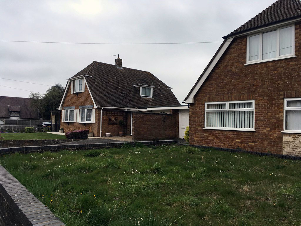
| House in Atherstone |
| Information | |
|---|---|
| County: | Warwickshire |
| District: | North Warwickshire |
| Population: | 11,552 (2020) |
Settlement in Atherstone dates back to Roman times with a Roman settlement in the adjoining village of Mancetter, the Roman road Watling Street running through the town. Boudicca may have been finally defeated by the Romans near to Atherstone in 60CE. Atherstone was listed in the Domesday Book (as Aderestone), held by Lady Godiva. The town was granted a yearly fair by King Henry III in 1246. Atherstone is close to the site of the battle of Bosworth, which may have actually taken place in fields near Atherstone and not Bosworth. The parish church dedicated to St Mary dates from the 12th century though in later centuries was extensively rebuilt, including giving it an octagonal tower.
Atherstone became an affluent market town surrounded by agricultural lands and in later medieval times a centre for cloth and textile manufacture, being well known for it's hat industry. The final hat factory not closing until 1999.
During the Industrial Revolution Atherstone was linked to the canal network by the Coventry Canal and the rail network by the West Coast Main Line though was eventually eclipsed by the likes of Birmingham and Coventry industrially.
 |
| On the Coventry Canal |
 |
| New Swan pub |
 |
| St Mary's church |
Chinnor is a village in South Oxfordshire close to the border with Buckinghamshire.
 |
| St Andrew's churchyard |
| Information | |
|---|---|
| County: | Oxfordshire |
| District: | South Oxfordshire |
| Population: | 5,924 (including neighbouring villages) (2011 census) |
There has been settlement in the area since the Iron Age, the name Chinnor may derive from the Saxon for "Ceona's Slope". Chinnor existed for sure in the late Saxon age, records of the village date from the reign of Edward the Confessor when the village was listed as being owned by Lewin, a royal servant. He held the village until the Norman Conquest when the village was granted to the de Vernon family. Later on, Chinnor was owned by the Earl of Winchester and until the late Middle Ages by the de Ferrers family.
Chinnor remained a small village for centuries, only seeing a spark in growth in the 1960s. The population more than doubled in size between 1951 and 1971. A major employer in the area was the Chinnor Cement & Lime Limited Company, this was finally closed down in 1999.
Chinnor's parish church is St Andrew which dates from 1160 although much of the current church dates from the 13th and 14th centuries. Chinnor station is the head quarters of the Chinnor & Princes Risborough Railway preserved line, the original station was closed in 1961, it re-opened in 1994.
 |
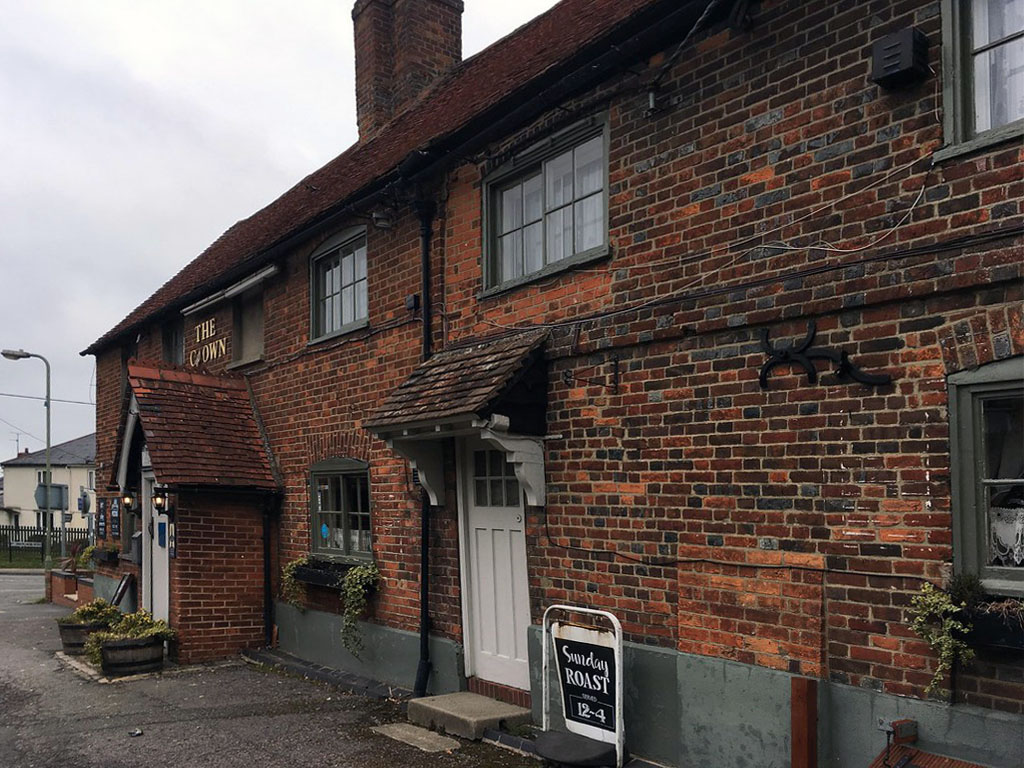
| The Crown pub |
 |
| Chinnor signal box |
 |
| St Andrew's church |
The station is a basic affair though does have direct trains to London, Birmingham and Hereford.

Colwall is a parish and village at the eastern edge of the county on the other side of the Malvern Hills from Malvern itself.
 |
| Clock tower with Colwall library behind |
| Information | |
|---|---|
| County: | Herefordshire |
| Parish: | Colwall |
| Population: | 2,400 (2011 census) |
There has been habitation in the area since the Iron Age, at the south east of the parish is the Iron Age British Camp, a fort which is thought to have been constructed in the 2nd century CE. At the time of the Domesday Book the area was part of the manor of the Bishop of Hereford a manor of Barton Colwall was created.
The parish was predominantly agricultural until the 19th century. The local econony grew after the establishing of a spa in Malvern and the opening of the railway via a tunnel under the hills. A bottling plant for Malvern water was opened in Colwall in 1892.
The parish church of St James the Great dates from the 12th century though was built on the site of an earlier Saxon church.
 |
| Probably not arrow slits but you never know |
 |
| Half-timbered house |
 |
| Crown Inn pub |
 |
| St James the Great |